


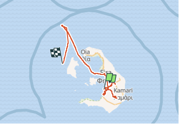
Santorin

jcm17
User

Length
60 km

Max alt
515 m

Uphill gradient
981 m
Km-Effort
73 km

Min alt
-6 m

Downhill gradient
982 m
Boucle
No
Creation date :
2022-06-10 14:04:10.907
Updated on :
2022-06-12 18:15:56.514
6h17
Difficulty : Very easy

FREE GPS app for hiking
 SityTrail
IGN / Geographical institutes
SityTrail Plus
The world is yours!
About
Trail Car of 60 km to be discovered at Aegean, Thira Regional Unit, Thira Municipal Unit. This trail is proposed by jcm17.
Positioning
Country:
Greece
Region :
Aegean
Department/Province :
Thira Regional Unit
Municipality :
Thira Municipal Unit
Location:
Unknown
Start:(Dec)
Start:(UTM)
359040 ; 4027919 (35S) N.
Comments